
Saturday, August 29
Late August Heat Persists Under Hazy Skies
A dry and hot late-summer pattern will continue across Kentucky this Saturday. While high-pressure ridging dominates the surface, a stream of upper-level moisture will bring varying degrees of cloudiness, especially to northern and western regions, though no significant rainfall is expected.
Confidence Assessment
High confidence in a dry day for 90% of the state; moderate uncertainty regarding the high-cloud opacity and the low-probability rain signal in the far south.
Get Personalized Forecasts
Choose which region in Kentucky you're interested in and we'll always show you that one first. You can change your selected region by clicking the "Star" icon on any regional forecast.
Purchase Area
A warm and humid day is expected across the far west. High temperatures will reach near 90 degrees under a veil of high clouds.
Northwest Pennyrile
The Owensboro area will see more clouds than sun today. While it will feel humid, no rain is in the forecast.
Southwest Pennyrile
The sun will be more frequent in the southern Pennyrile, pushing temperatures into the low 90s.
Barren River
Expect plenty of sunshine with highs near 90. A late evening cloud increase is possible, but rain chances remain very low.
Louisville Metro
Louisville will see filtered sunshine through high clouds. Highs will reach the upper 80s with warm overnight lows.
Lincoln Trail
A pleasant late-August day with highs in the upper 80s and mostly sunny skies.
Lake Cumberland
Sunny and hot for Somerset. While some models hint at evening rain, dry air is expected to win out.
Northern Kentucky
Expect a mostly cloudy day in Covington and Newport as high clouds block the sun. Temperatures stay in the mid-80s.
Inner Bluegrass
Horse country will see plenty of sun and highs near 88 degrees. A very light breeze will offer little relief.
Bluegrass Foothills
A beautiful Saturday for Richmond and Berea. Highs will stay in the upper 80s with no rain expected.
Northeast Kentucky
Temperatures will climb rapidly today, peaking in the low 90s. The morning will start clear and crisp.
Southeast Kentucky
The mountains will stay dry and warm with temperatures in the upper 80s. A few clouds may drift in late.
Possible Outcomes
Weather forecasting involves uncertainty. Below are two scenarios representing the range of possible outcomes: the "Boom" scenario shows the worst-case/highest-impact result if conditions align unfavorably, while the "Bust" scenario shows the best-case/lowest-impact result if the forecast doesn't materialize as expected.
The 'Boom' Scenario
A weak southern-tier disturbance overcomes the ridge's cap, resulting in scattered light showers (0.05") for the Lake Cumberland and Coalfield regions by late evening.
The 'Bust' Scenario
The ridge remains completely impenetrable with zero cloud cover, allowing temperatures in the eastern valleys to overachieve and reach the mid-90s.
Model Disagreements
When models disagree, a call must be made to determine the most likely outcome. This decision is based on a combination of factors including model performance, historical data, and the models general accounting of each climatic region of Kentucky.
The Southern Moisture Mirage
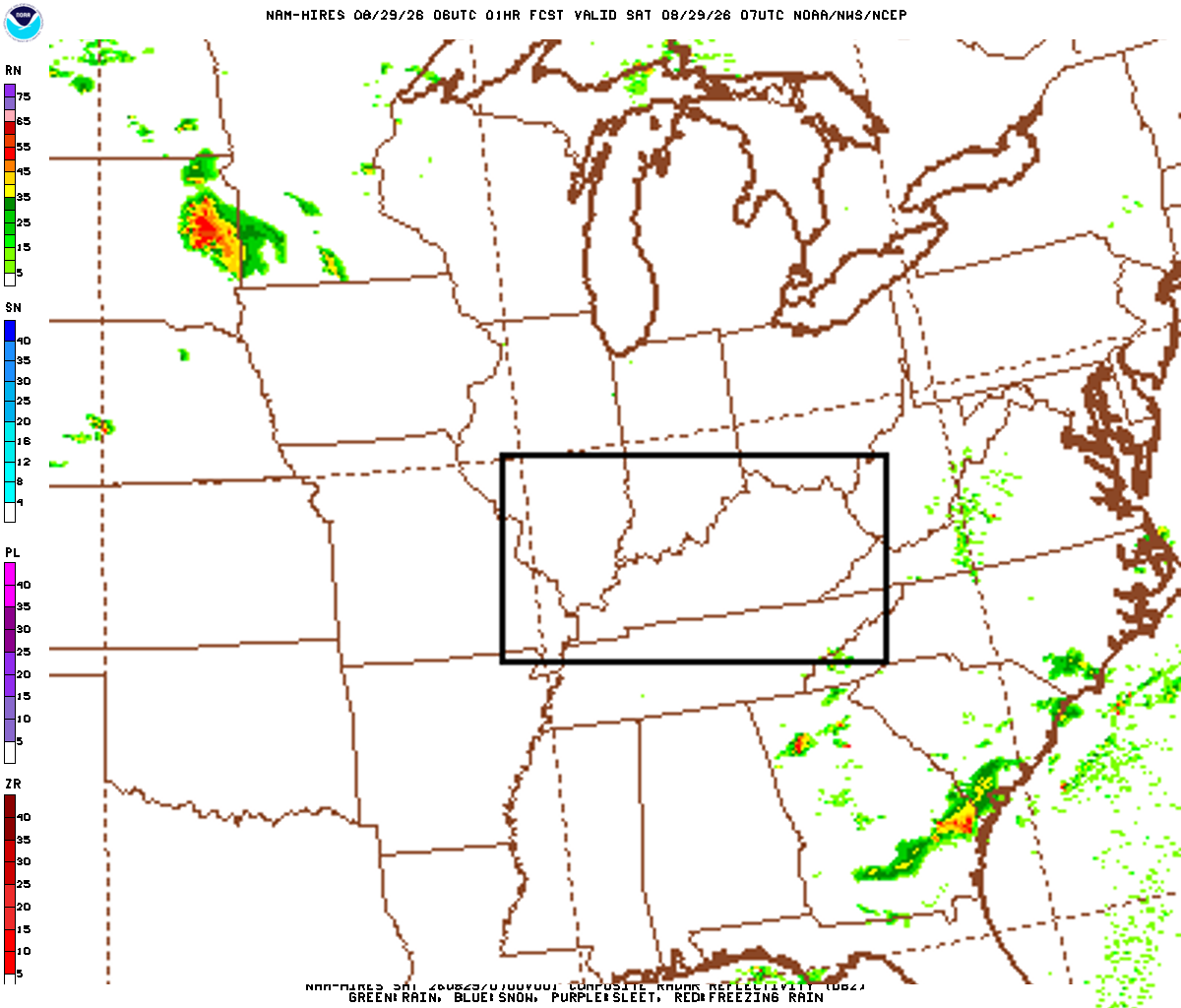
The NAM attempts to resolve a weak vorticity lobe in the Tennessee Valley, producing light stratiform rain in southern KY, while the GFS and Euro maintain a bone-dry column under a 594dam ridge.
Why EURO Wins
Synoptic-scale ridging of this magnitude is notoriously difficult to break with weak mesoscale ascent; the Global models correctly prioritize subsidence over light isentropic lift in this regime.
The Cirrus Shield Conflict
Disagreement on the opacity of the upper-level cloud deck. The Euro shows thick cirrostratus in the north, while GFS remains aggressively clear.
Why EURO Wins
The Euro historically handles jet-level moisture transport and high-altitude albedo effects with greater precision than the GFS.
Celestial Almanac
Waning Gibbous
Purchase Area
Northwest Pennyrile
Southwest Pennyrile
Barren River
Louisville Metro
Lincoln Trail
Lake Cumberland
Northern Kentucky
Inner Bluegrass
Bluegrass Foothills
Northeast Kentucky
Southeast Kentucky
Forecast Charts
These maps are generated by the weather agencies based on the raw data that the weather models predict. The final forecast is generated using the same raw data shown on the map. Keep in mind that the models (and therefore the maps) will generally disagree on specific parts of the forecast. Use these as guidance - not as a final prediction.
Dive Deeper Into the Models
This forecast is a synthesis of raw data from the NAM, GFS, ECMWF, and GEM models. These models provide detailed atmospheric analyses including 500mb vorticity, precipitation rates, and more. You can take a look at the raw model data by clicking the links below.