
Thursday, July 23
Pleasant and Dry Summer Day Across the Commonwealth
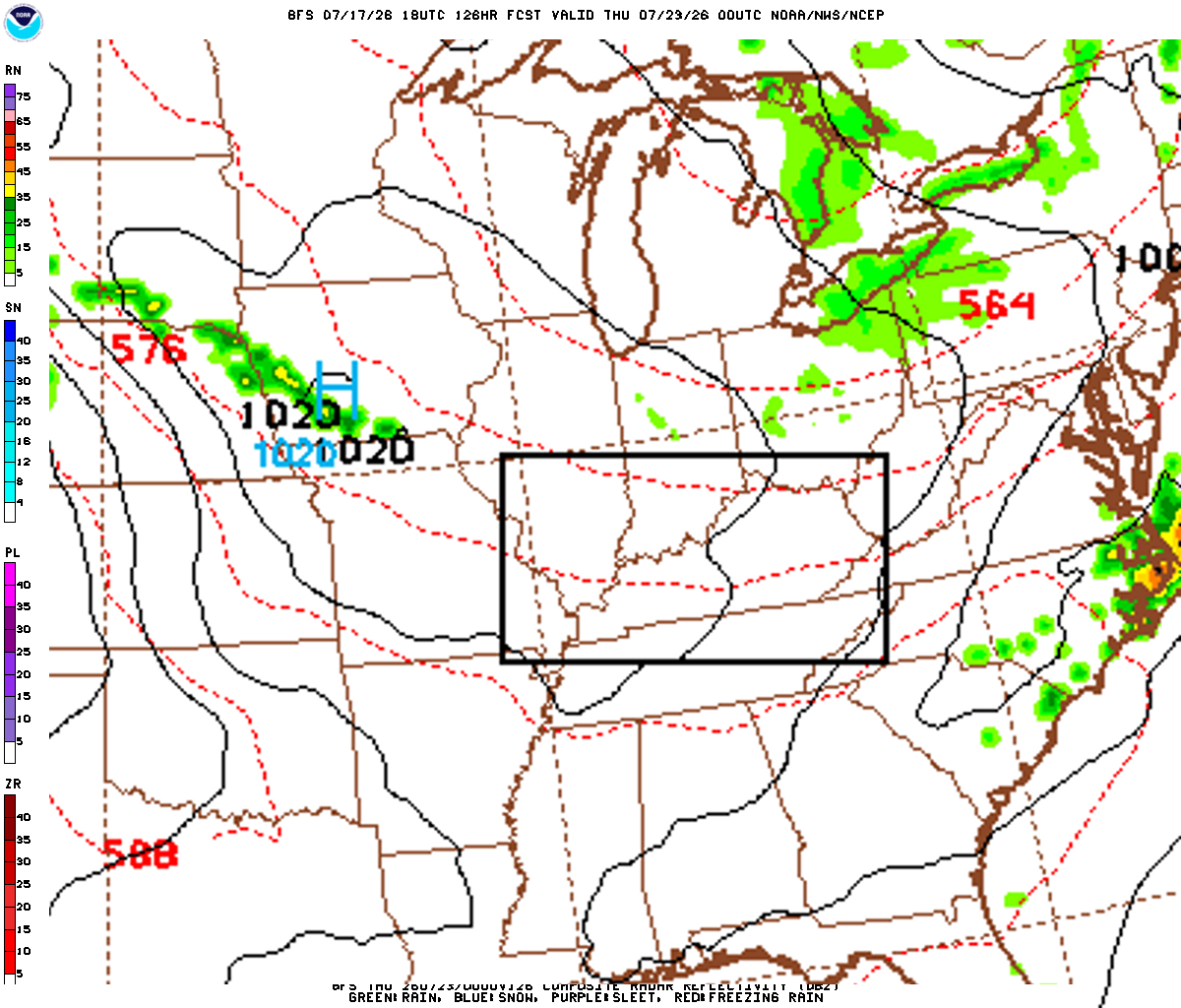
Kentucky will enjoy a settled and mild summer day on Thursday as strong high pressure centers itself over the Ohio Valley. Expect plenty of sunshine for most of the state, with comfortable humidity levels and temperatures slightly below late-July averages. A thin veil of high-level clouds will drift into Western Kentucky during the afternoon, but dry conditions will prevail statewide.
Confidence Assessment
High confidence in dry conditions due to the 1020mb high. Points were deducted solely due to the forecast being 6 days out and minor timing differences regarding cloud cover in Western Kentucky.
Get Personalized Forecasts
Choose which region in Kentucky you're interested in and we'll always show you that one first. You can change your selected region by clicking the "Star" icon on any regional forecast.
Purchase Area
Expect a mix of sun and clouds, with clouds becoming more dominant in the afternoon. No rain is expected.
Northwest Pennyrile
A beautiful, sunny day with light winds and comfortable temperatures for late July.
Southwest Pennyrile
A nice day with a mix of sun and clouds. Temperatures will reach the low 80s with low humidity.
Barren River
The Bowling Green area will see plenty of sun and comfortable afternoon highs.
Louisville Metro
A sunny day for the Metro area with very low humidity and light winds.
Lincoln Trail
A sunny day with light breezes, perfect for outdoor travel near Elizabethtown.
Lake Cumberland
Great weather for the lake with light winds and sunny skies.
Northern Kentucky
A crisp morning will lead to a very comfortable and sunny afternoon with light winds.
Inner Bluegrass
Lexington and surrounding areas will enjoy plenty of sunshine and pleasant temperatures.
Bluegrass Foothills
A very mild and sunny day for the Richmond and Danville areas.
Northeast Kentucky
A cool start in the valleys will lead to a beautiful, sunny day with very low humidity.
Southeast Kentucky
The mountains will see clear skies and very mild temperatures today.
Possible Outcomes
Weather forecasting involves uncertainty. Below are two scenarios representing the range of possible outcomes: the "Boom" scenario shows the worst-case/highest-impact result if conditions align unfavorably, while the "Bust" scenario shows the best-case/lowest-impact result if the forecast doesn't materialize as expected.
The 'Boom' Scenario
If the ridge builds more aggressively and high-level clouds remain thinner than expected in the west, temperatures could over-perform by 2-3 degrees, pushing several regions into the mid-80s.
The 'Bust' Scenario
If the mid-level moisture currently over the Ozarks advects faster, a more robust cirrus shield could limit afternoon heating in the Purchase and Pennyrile, holding highs in the upper 70s.
Model Disagreements
When models disagree, a call must be made to determine the most likely outcome. This decision is based on a combination of factors including model performance, historical data, and the models general accounting of each climatic region of Kentucky.
The Western Cloud Shield
A disagreement exists regarding the eastward extent of high-level cirrus. The GFS 'smear' effect suggests widespread overcast for the western half of KY, while the Euro maintains a sharper cutoff of the dry air aloft.
Why EURO Wins
The Euro handles the mid-level dry slot with better vertical resolution, which is consistent with the current water vapor satellite trends showing strong subsidence over the mid-Mississippi valley.
Eastern Valley Drainage
Global models like the GFS are struggling to resolve the depth of the nocturnal inversion in the deep valleys of the Coalfields, leading to warmer overnight lows compared to higher-resolution guidance.
Why NAM Wins
The NAM captures the Cold Air Damming and localized drainage effects in the mountainous terrain far better than the coarse GFS grid.
Celestial Almanac
Waxing Gibbous
Purchase Area
Northwest Pennyrile
Southwest Pennyrile
Barren River
Louisville Metro
Lincoln Trail
Lake Cumberland
Northern Kentucky
Inner Bluegrass
Bluegrass Foothills
Northeast Kentucky
Southeast Kentucky
Forecast Charts
These maps are generated by the weather agencies based on the raw data that the weather models predict. The final forecast is generated using the same raw data shown on the map. Keep in mind that the models (and therefore the maps) will generally disagree on specific parts of the forecast. Use these as guidance - not as a final prediction.
Dive Deeper Into the Models
This forecast is a synthesis of raw data from the NAM, GFS, ECMWF, and GEM models. These models provide detailed atmospheric analyses including 500mb vorticity, precipitation rates, and more. You can take a look at the raw model data by clicking the links below.