
Saturday, July 25
Widespread Saturday Rain Focuses on Western Kentucky
A moisture-rich summer weather system will bring widespread rain across Kentucky on Saturday. The heaviest accumulations are expected in the Purchase and Southwest Pennyrile regions, with totals gradually decreasing toward the northeast where drier air may limit precipitation to light sprinkles or virga.
Confidence Assessment
Confidence is moderated by the five-day lead time and the inherent difficulty in forecasting the exact northern boundary of a summer moisture plume.
Get Personalized Forecasts
Choose which region in Kentucky you're interested in and we'll always show you that one first. You can change your selected region by clicking the "Star" icon on any regional forecast.
Purchase Area
Expect a very wet morning across the Purchase region with rain totals approaching an inch. Conditions will remain damp and overcast through the evening, though the heaviest rain will exit by noon.
Northwest Pennyrile
Intermittent rain showers will persist through the first half of the day. Rain totals will stay around a half-inch, making for a cloudy and gray Saturday.
Southwest Pennyrile
This region will see some of the highest rainfall totals in the state today, reaching up to one inch. Steady rain in the morning will transition to scattered light showers by late afternoon.
Barren River
Steady rain will impact the Bowling Green area throughout the morning hours. Expect around 0.9 inches of rain, with clouds lingering into the night.
Louisville Metro
The heaviest rain will pass to the south of Louisville, but light showers are still likely. Accumulations will be light, generally around 0.2 inches.
Lincoln Trail
Steady light rain is expected through the morning with totals around a half-inch. A cool and gray day with temperatures remaining in the 70s.
Lake Cumberland
Expect consistent rainfall for Somerset and surrounding areas during the afternoon. Around 0.6 inches of rain is expected before showers taper off late Saturday.
Northern Kentucky
Northern Kentucky will see the least rain, with most activity likely evaporating before hitting the ground. A few sprinkles are possible, but significant accumulation is not expected.
Inner Bluegrass
Lexington will see periods of light rain throughout the day. Totals will be minimal, around 0.2 inches, under heavily overcast skies.
Bluegrass Foothills
Showers will move into the foothills by early afternoon. Expect around 0.4 inches of rain with overcast conditions for most of the day.
Northeast Kentucky
Ashland and Grayson will stay mostly dry until the afternoon hours. Light rain will move in during the evening, totaling around 0.2 inches.
Southeast Kentucky
Morning fog in the valleys will give way to steady rain showers in the afternoon. Expect around a half-inch of rain as the system moves over the higher terrain.
Possible Outcomes
Weather forecasting involves uncertainty. Below are two scenarios representing the range of possible outcomes: the "Boom" scenario shows the worst-case/highest-impact result if conditions align unfavorably, while the "Bust" scenario shows the best-case/lowest-impact result if the forecast doesn't materialize as expected.
The 'Boom' Scenario
A slower trough progression would allow the moisture plume to dwell longer over the Bluegrass and Eastern Coalfields, potentially doubling rain totals to 1.0-1.5 inches in these areas.
The 'Bust' Scenario
A faster, more open wave combined with aggressive dry air entrainment at the 850mb level could result in rainfall amounts staying under a quarter-inch for everyone except the far western counties.
Model Disagreements
When models disagree, a call must be made to determine the most likely outcome. This decision is based on a combination of factors including model performance, historical data, and the models general accounting of each climatic region of Kentucky.
The Northern Moisture Cutoff
Models are in conflict regarding how far north the deep moisture shield penetrates. The GFS suggests light rain reaching the Ohio River, while the Euro maintains a sharper cutoff due to dry air entrainment.
Why EURO Wins
The ECMWF historically handles mid-level moisture boundaries and the 'dry slot' effect with higher precision than the GFS in the day 5 timeframe.
Celestial Almanac
Waxing Gibbous
Purchase Area
Northwest Pennyrile
Southwest Pennyrile
Barren River
Louisville Metro
Lincoln Trail
Lake Cumberland
Northern Kentucky
Inner Bluegrass
Bluegrass Foothills
Northeast Kentucky
Southeast Kentucky
Forecast Charts
These maps are generated by the weather agencies based on the raw data that the weather models predict. The final forecast is generated using the same raw data shown on the map. Keep in mind that the models (and therefore the maps) will generally disagree on specific parts of the forecast. Use these as guidance - not as a final prediction.
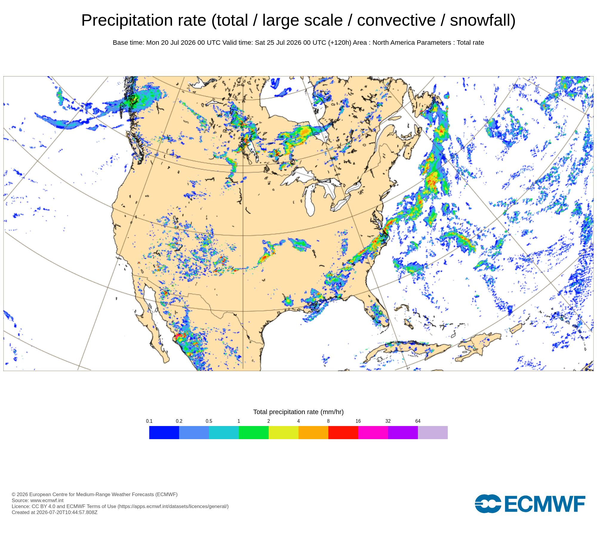
Dive Deeper Into the Models
This forecast is a synthesis of raw data from the NAM, GFS, ECMWF, and GEM models. These models provide detailed atmospheric analyses including 500mb vorticity, precipitation rates, and more. You can take a look at the raw model data by clicking the links below.